Idaho Hot Springs Mountain Bike Route
01
Ideation
In 2013, Adventure Cycling Association set out to add a new off-pavement route to its growing national network of mapped bicycle routes. The goal was to create something that could be completed in a couple of weeks—capturing the spirit and challenge of the Great Divide Mountain Bike Route, but without its 2,700-mile scale.
In the preceding decade, a small group of cyclists and adventurers had begun pioneering a new approach to off-pavement touring: bikepacking—a convergence of traditional bike touring and backpacking. The philosophy was simple: travel light and move efficiently to reach remote places that conventional road touring rarely accessed.
One summer, a friend and I mapped every rentable forest fire lookout in the Northern Rockies and designed a bikepacking-style trip linking them together. Over ten days, we stayed in eight different lookouts. The experience sparked a larger question: what other remote destinations could anchor a similar route?
It didn’t take long for hot springs to come to mind.
02
Research
The first step was determining whether a hot springs route was truly feasible. Were there enough springs to justify the concept? Could they be logically connected? Would casual bike tourists participate if the route required mandatory singletrack? The only way to answer these questions was through research.
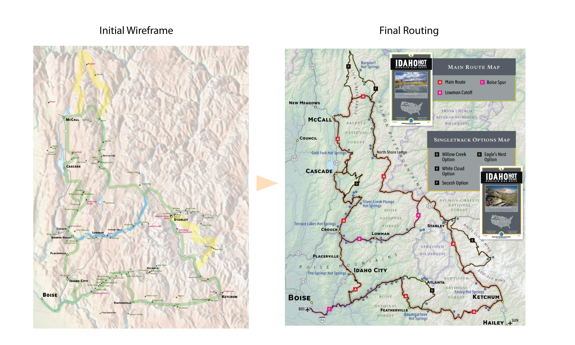
After plotting the hot springs—more than 50 of them—it became clear there was critical mass. From there, rough corridors were drawn to connect the springs with towns where riders could resupply. What followed was more than a month of detailed field and desk research examining roads, trails, soak sites, and available services. Every element had to be vetted to ensure a positive rider experience.
To create accurate narrative directions, I stood in each intersection, recorded a GPS point, and wrote down exactly what a rider would see from either direction. This level of precision ensured confident navigation and eliminated ambiguity. As one group later shared:
“The paper Adventure Cycling map said to go straight ahead, but the route I had mapped on ridewithgps.com said to turn right, so we did, but the road got very steep and narrow, and it just didn’t seem like the obvious way to go. We backtracked and consulted the maps again, and eventually decided to follow the instructions on the paper map… I felt better now that we were back on the route.”
— Fatbike Brigade, 2017
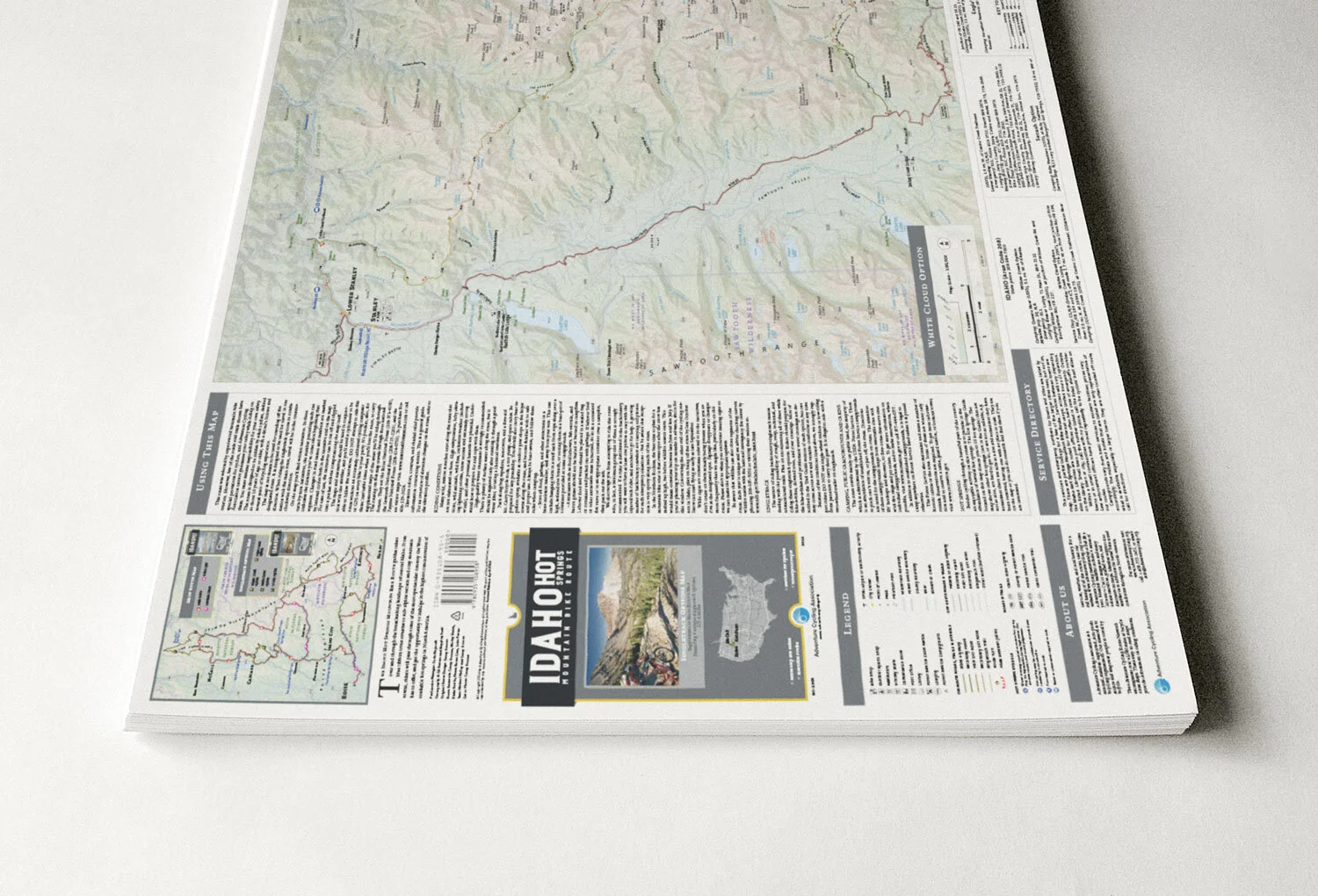
The design intentionally avoided mandatory singletrack to broaden accessibility. Instead, four optional backcountry singletrack alternates were created. A spur to the Boise airport was designed to provide logistical access to Idaho’s remote interior. Additionally, a paved connector was incorporated to divide the 500-mile primary dirt-road routing into more manageable segments.
03
Outcome
The result was the first map set in Adventure Cycling Association’s history to require three print runs within a single year. Business goals were exceeded, and user feedback has remained overwhelmingly positive.
The most challenging lesson came from the optional singletrack sections. Riders consistently reported them to be more difficult than advertised. Idaho trails are often rougher and less manicured than those in other parts of the country, and the expectations didn’t always align with reality. In response, I revised the descriptions and strengthened the warnings based on rider feedback. I’ve even advocated for removing the segments altogether. However, a dedicated subset of riders continues to seek them out—and they do lead to some of the most spectacular and remote hot springs on the route.
Ultimately, the project balanced ambition with adaptability—meeting business objectives while evolving in response to real-world user experience.